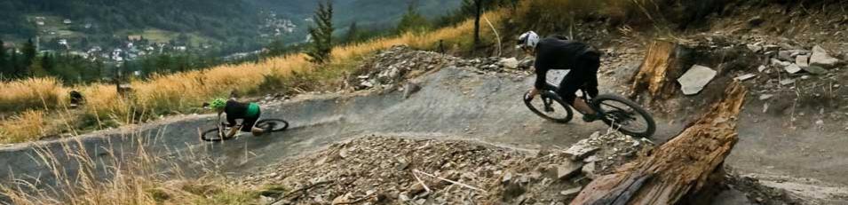
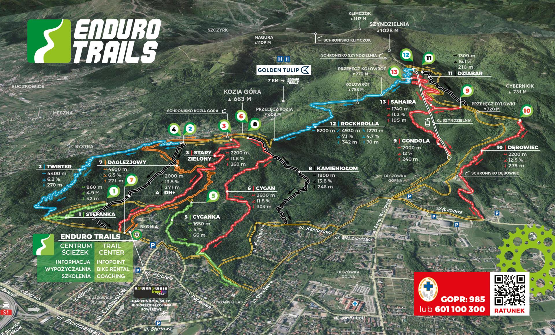
The Enduro Trails mountain bike trail park is located in the City of Bielsko-Biała. It is a network of one-way bike trails or so-called singletracks. These popular mountain bike trails are twisty, narrow and undulating with varied levels of difficulty, from the gently descending easier trails to the steep and technical downhills. Most of the trails were built for the Enduro racing event periodically held here (hence the name of the trail network).
The trail centre (with tourist information and surrounding facilities) is located at the foot of Kozia Góra (the City’s recreational area is called “Błonia”). The trails are scatterred between Szyndzielnia and Kozia Góra (in the Klimczok mountain massif). Szyndzielnia rises up to the height of 1030 metres above sea level. The peak can be reached by a modern gondola lift. Kozia Góra is a smaller hill (686 m a.s.l.) with a rich tourist culture. The longest toboggan run in Europe used to operate here.(the structures are still clearly visible). On both mountains you can also find cozy huts dating back to the 19th century.

Trails
The Enduro Trails mountain bike trail complex is located in the City of Bielsko-Biała.
| Trasa | Aktywna |
| Stefanka | |
| Cyganka | |
| RockNRolla | |
| Bystry | |
| Twister | |
| SahAira | |
| Gaciok | |
| Stary Zielony | |
| Cygan | |
| Gondola | |
| Debowiec | |
| Dziabar | |
| DH+ | |
| Kamieniołom | |
| Daglezjowy |
| Destiny: | for beginner mountain bikers |
| Average slope: | 4-6% |
| Surface: | even, paved |
| Difficulties: | sharp turns with and without banked corners, occasionally, small natural obstacles may be encountered (stones, roots), slippery or loose surfaces (small pebbles), small puddles and wooden bridges |
| Required skills: | effective cornering and braking |
| Opening hours: | 6:00 - 22:00 |
| Destiny: | for intermediate mountain bikers |
| Average slope: | 6-9% |
| Surface: | even and paved or mixed |
| Difficulties: | sharp turns, larger bumps and banked corners, small natural obstacles (roots, stones) |
| Required skills: | confident braking, cornering, dealing with bumps and banked corners and other small obstacles and unevenness |
| Opening hours: | 6:00 - 22:00 |
| Destiny: | for advanced mountain bikers |
| Average slope: | 9-13% |
| Surface: | natural and mixed |
| Difficulties: | sharp turns and banked corners, high speeds, larger natural obstacles (e.g. root and stone sections), small artificial obstacles (e.g. ramps without gaps or with a bypass), slippery surfaces |
| Required skills: | fast braking, cornering, dealing with larger obstacles (roots, drops, small ramps) |
| Opening hours: | 6:00 - 22:00 |
| Destiny: | for expert mountain biker |
| Average slope: | 13-18% |
| Surface: | natural |
| Difficulties: | sharp turns and banked corners frequent natural obstacles (e.g. root and boulder sections, steep slope and ground drops), larger artificial obstacles (e.g. ramps with gaps, with or without a bypass), slippery surfaces |
| Required skills: | perfect braking, cornering, ability to jump over and deal with difficult terrain (e.g. steep walls, drops and ramps) |
| Opening hours: | 6:00 - 22:00 |
| Destiny: | |
| Average slope: | |
| Surface: | |
| Difficulties: | |
| Required skills: | |
| Opening hours: | 6:00 - 22:00 |
Twister

02
Trail for intermediate bikers. COLOR BLUE
A not very steep but very winding trail.
RockNRolla

12
The longest and the most variable trail in the complex.
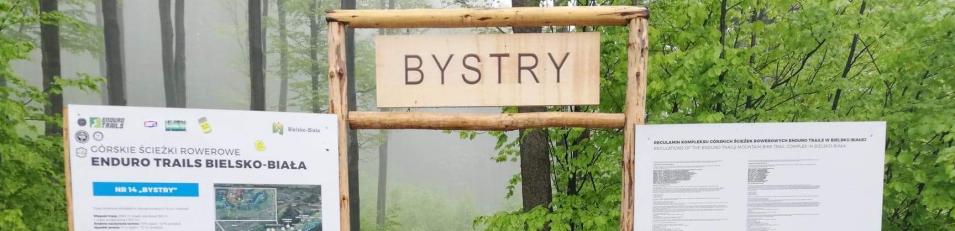
Bystry
14
A wide flow trail with plenty of jumping elements.
Twister
| Route status: | Length: | Average grade: | Vertical drop: | Trace: |
|---|---|---|---|---|
| Open | 4400M | 6.2% | 270M | Download |
A not very steep but very winding trail. It starts on the eastern slope near the top of Kozia Góra. Getting to the start of the trail from Błonia takes ca. 45 minutes. Suitable for almost all mountain bikers but bikers should be prepared for largish banked corners and bumps. Its length should also be taken into consideration!
Partners